

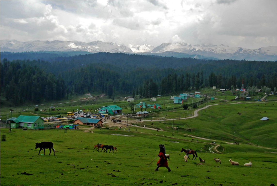
Not flowers alone, the fascinating Yousmarg is the source of some of the best streams and a base for a chain of trekking and expeditions, writes Dr Raja Muzaffar Bhat
From my childhood, I have been passionate about trekking across Kashmir. I was only nine years old when I went camping with my school to Yusmarg. This was the summer of 1986. We stayed there for three days exploring the area. We trekked to Nilnag from Yusmarg and came back in the evening. This was the time when I first time saw Cobra Plants in the forest. We camped near the small stream which flows through the Yusmarg meadow.
Yusmarg was neat and clean those days and plastic waste was hardly visible. When I was in class V, we went for an annual camp to Aharbal, which was around July 1987. My school, Tyndale Biscoe School Srinagar has been a pioneer in extra-curricular activities. Camping apart, trekking or hiking, swimming and water sports was a unique activity in our school and we were privileged to have these facilities. There was a swimming pool in our school and we had weekly regattas during the summer months in Dal Lake every Wednesday. Only those boys were allowed to participate in regattas who had passed the swimming test in the school swimming pool. There was an annual one-mile and Dal Cross swimming championship held as well in Dal Lake around August every year.
Kashmir Post 1990s
Before the 1990s hardly any school would take their students camping. Nobody could imagine school students summiting Kolohai, Tatakuti, Harmukh or Mahadev peaks. I remember Biscoe boys from senior classes IX and X would explore these peaks and these expeditions were held during the 1940s, and 1950s and continued till the late 1980s. As we grew up the situation in the 1990s became not feasible for such adventures.
Between 1990 and 2000 hardly any trekking and mountaineering expeditions were organised by educational institutions due to security reasons. Many trekking routes in the summer months were patrolled by the Army, especially in the Pir Panjal mountain range from Gulmarg to Tosamaidan. From Tosamaidan and upper Doodhpathri and Yusmarg, one had to take proper permission for the movement. Then, there was a lot of militant infiltration as the meadows led towards the LoC area in the Swagian (Poonch) sector through the Noorpur pass (Noorpur Gali)
Even the nomadic Bakerwals and local herdsmen had to get proper permission from the authorities. Around 2005, I resumed my trekking, initially starting to explore the virgin destinations in Budgam’s Doodh Ganga and Shali Ganga valleys. Both these small rivers originate from the glaciers of the Pir Panjal mountains.
Trekking Trials
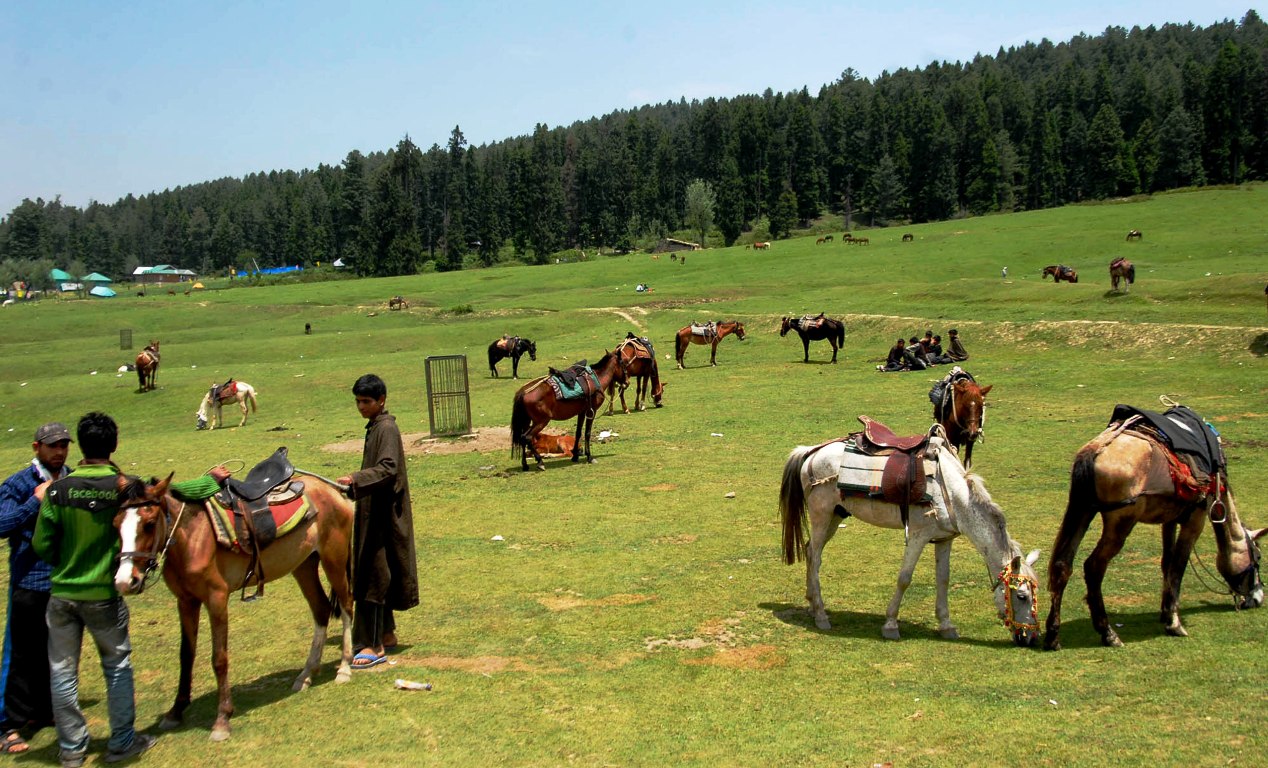
I along with my friends would start trekking from Branwar, the last motorable village, 35 km from Srinagar, located in North West of Yusmarg. We would usually move towards Frasnag and Mech e Khanain rangelands via Haijan meadow. Frasnag and Mech Khanain are two rangelands where nomadic Gujjars from Branwar, Bonen and surrounding villages take their livestock in summer.
Pastoralist communities, the Chopans, from Budgam and Bakerwals from Rajouri rest in these meadows around May end and by June mid they start moving ahead towards Chaskani Nad and other highland pastures of Pir Panjal forest division. This movement gets sometimes delayed due to rain and bad weather in June.
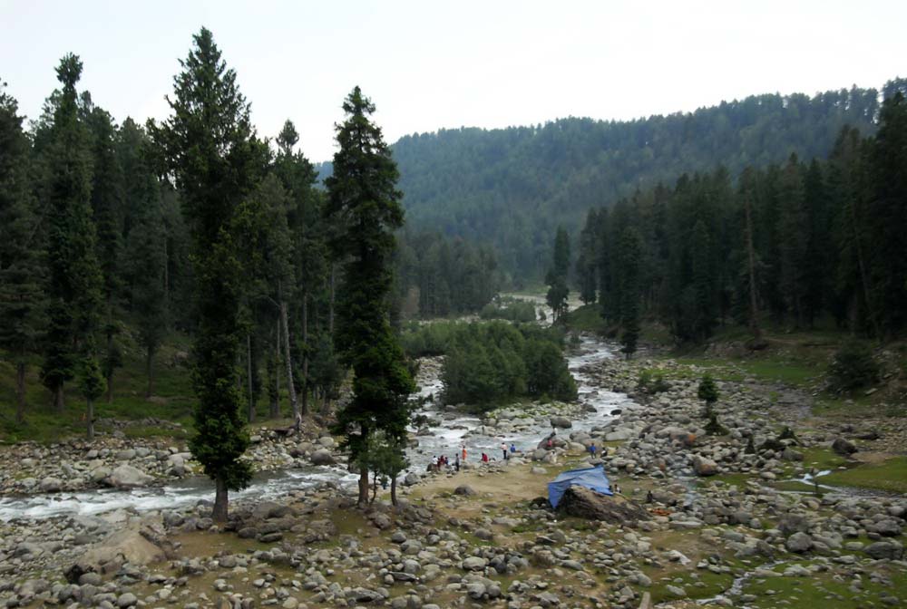
Frasnag and Mech e Khanain pastures are located on Doodh Ganga banks and can be explored via Yusmarg also. It is around an hour’s walk towards South West of Yusmarg Bowl. There were a large number of trout fish in Doodh Ganga 15 years back and we would fish the whole day and return to Branwar late evening.
The Branwar Village
On Sundays, I would routinely visit Branwar. I was practising Dentistry as part of my social work. There, I began my RTI activism. We set up a small civil society group in the area known as the Awami Insaf Committee (Peoples Justice Committee) around 2008.
During my frequent Branwar visits, I developed friendships with many locals – Khurshid Ahmad Kuchay, Nasardin Kalas, and Khurshid’s younger brothers Farooq and Sajad.
Kuchay brothers made me and my friends familiar with the forests and meadows of the Doodh Ganga forest range. We once visited the bahak of Nasardin Kalas at Godkhal around 7 km up Branwar and stayed in his mud hut.
A Disaster
After 2011 things changed drastically as the natural course of Doodh Ganga was shifted from Mech e Khanian meadows to pave the way for setting up of a small 7.5 MW hydropower project at Branwar. This was a Run of River mico-hydropower project that used the natural downward flow of Doodh Ganga and microturbine generators to capture the kinetic energy. The project was leased out to a Chandigarh-based company under the Build Own Operate and Transfer (BOOT) model for 40 years.
The Doodh Ganga was thus diverted near Mech e Khanain via Soipathri, Kandikhal, Dupkhal, and Hamkhal meadows through a manmade canal by digging the lush green meadows with hydraulic cranes (JCB etc). This was like a disaster.
The canal dug up with JCBs and cranes enters into a large pipeline which is spread over a kilometre near Haijan meadow. The water from these pipes then comes down at Branwar with a huge gush and this generates the electricity. During the construction of this project, a lot of trees were axed. Residents told me that they were given assurance by the then Finance Minister A R Rather that they would get subsidised electricity but that never happened.
The original course of Doodh Ganga dried up between Mech e Khanain to Branwar (6 km downstream) which made it very unnatural and dry. Only a small canal called Kalnag joins Doodh Ganga near Frasnag but that has little water supply and thus Doodh Ganga around Yusmarg right now has 70 per cent less water than what it used to have before 2010.
Trekking
I have been trekking in the upper Yusmarg and Doodhpathri areas for more than 16 years now. This area is so vast that we still have not explored it fully. Every year I go and explore new meadows and alpine lakes but still, I am unable to reach out to this vast area.
From Yusmarg one can hike and trek towards Poonch through different passes. The main mountain pass that connects Budgam with Poonch is Noorpur Gali, which is located at an altitude of 4100 meters (13451 feet). Besides, there are other gali’s (mountain passes that connect Poonch with Yusmarg, Doodhpathri and also Tosamidan and Gulmarg.

Jamia Gali: This starts from the Gagrian Swajian area of Pooch and then via Barshi Nallah, Barnara Marg, and Jamia Marg we reach Jamia Gali and then the Gulmarg -Tangmarg area. Jamia Gali is located at an altitude of around 4419 meters (14500 feet)
Noorpur Gali: This connects Loran (Poonch) with Yusmarg, Doodhpathri and Tosamaidan as well via Sultan Pathri. Noorpur Gali is around 4093 meters in height and it is open from July to September. After crossing Noorpur Gali one can reach Yusmarg by trekking towards the east for 10-12 hours. It is advisable to halt at Ashtar Valley which is a 3 to 4 hours trek from Noorpur Gali. Ashtar Valley is located under the foothills of Tatakoti Mountain. Shali Ganga stream a tributary of Doodh Ganga flows through this valley which is an incredible place. From Ashtar Valley one can reach Doodhpathri in five hours and Yusmarg in 8 to 9 hours.
The Best Pass
There are other smaller passes like Choti Gali, and Chor Gali connecting Poonch with Yusmarg, Doodh Pathri and Tosmaidan but it is advisable to trek to the Poonch area via Noorpur Gali only which is safe and easy.
I have myself gone to Nurpur Gali in 2010 from Tosamaidan. We started from Arizal and halted for a night stay at the Khala Khath area of Tosamaidan and the next day we started our journey at 8 am and by 1 pm we were at Noorpur Gali. We then came back via Doodhpathri and halted for the night around Ashtar Valley. From Yusmarg one can trek to Doodhpathri and this is around 8 hours trek.
Other locations to trek from Yusmarg are Bargah, Dandneur, and Liddermud. These are lush green meadows that one can reach in 3 to 4 hours from Yusmarg. The Bargah meadow is inhabited by shepherds from Pulwama and one can trek towards the Kacha-Goul glacier which is the origin of Romshi nallah which flows through various areas of Pulwama. This is 8 to 9 hours to and fro distance from Bargah meadows.
Tatakoti and Sunset peaks can also be explored through Yusmarg and this is a 3-day expedition usually wherein hikers have to shift the campsite from one place to another. The entire Yusmarg area has beautiful flowers right from May to September and they look extremely beautiful, especially near the alpine lakes of Trusar and Makroo Sar.
(The author is a Srinagar-based Acumen Fellow and has been writing and campaigning on good governance, sustainable development and climate action. Ideas are personal.)
The post My Yusmarg Treks appeared first on Kashmir Life.