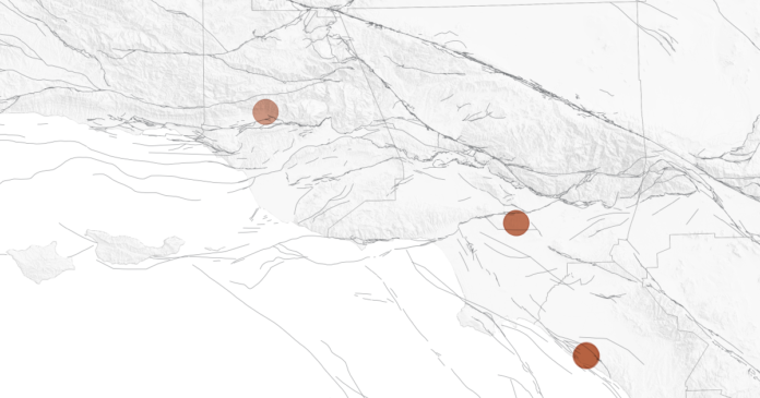
A three-dimensional mapping of last week’s El Sereno quakes under the Earth’s surface found they were just beneath the plane of the Puente Hills thrust fault, a terrifying fault that has received far less attention than the San Andreas but is capable of generating catastrophic shaking.
A magnitude 7.5 quake on the Puente Hills fault — which runs under highly populated areas of L.A. and Orange counties — could kill 3,000 to 18,000 people, according to the USGS and Southern California Earthquake Center.
That’s worse than the hypothetical death toll of 1,800 people from a plausible magnitude 7.8 earthquake that begins on the southern San Andreas fault near the Mexican border and unzips all the way to the mountains of L.A. County.
“This is a very, very large fault, located in about the worst possible place you could imagine for a fault beneath L.A.,” Dolan said.
The Puente Hills thrust fault was discovered only recently — in 1999 — by John Shaw of Harvard University and Peter Shearer of Scripps Institution of Oceanography at UC San Diego, who concluded that the 1987 Whittier Narrows quake, which killed eight people, ruptured a small portion of this fault.
The Puente Hills thrust fault is particularly worrisome when it ruptures in its entirety because of what’s on top of it — downtown Los Angeles, which has many old and unretrofitted buildings, as well as broad swaths of southeast L.A. County, the San Gabriel Valley and northern Orange County.
“This thing is enormous,” Dolan said.
The fault is like an angled ramp deep underground — deepest along the 210 Freeway corridor, where it is about 10 miles deep, and shallowest about a mile south of USC, where it is 2 miles under the surface.
This orientation is particularly bad if the entire fault ruptures because the shaking would commonly begin at the deepest end and move to the shallowest — meaning the shaking energy would likely move from the suburbs of the foothills toward downtown.
“Where’s all that energy … going to end up? It’s going to end up at the top of the ramp,” Dolan said. “That, unfortunately, is right in the core of the L.A. metropolitan region.”
The shaking also will arrive at the edge of the Los Angeles Basin, a 6-mile-deep, bathtub-shaped hole in the underlying bedrock filled with weak sand and gravel eroded from the mountains and forming the flat land where millions of people live. The area stretches from Beverly Hills through southeast L.A. County and into northern Orange County.
When earthquake energy is sent into these sedimentary basins, Dolan said, it amplifies the intensity of the shaking — perhaps 10 times worse than if someone were on bedrock — and also causes shaking to resonate like a bowl of Jell-O, extending the duration.
“So the Puente Hills thrust is both, in terms of its location and its geometry, a particularly dangerous fault for Los Angeles,” Dolan said.
There is one silver lining: Unlike the San Andreas fault, which generates a big earthquake on average every 100 years or so, the Puente Hills thrust fault generates big quakes only every couple of thousand years, Dolan said.


